Hiking

Medium

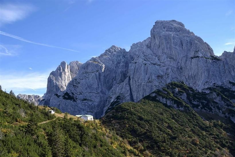
Stripsenjoch

Hiking tour

3,50 km

04:30 h

633 hm

58 hm

1578 m

Best Time of Year

Jan

Feb

Mar

Apr

May

Jun

Jul

Aug

Sep

Oct

Nov

Dec

Information

You drive via Schwendt to Griesenau and from there a toll road leads to Kaiserbachtal. You can park there in front of the toll booth and walk along the approx. 4 km Schnackler adventure trail with outdoor gallery to the Griesner Alm. Or you go by car to the Griesner

Read more ...

Recommended Equipment

appropriate clothing, proper footwear, backpack, rain protection, possibly hiking poles, mobile phone, sunscreen, snacks and drinks, possibly photo camera

Features & Characteristics

Endurance

Skill Level

Starting Point

Griesneralm

End Point

Stripsenjochhaus

Map & Elevation Profile

Arrival

By car through Schwendt to the district of Griesenau (district of Kirchdorf i.T.)

Similar Tour Suggestions

Heuberg

Medium

Hiking

Hiking tour

Starting Point: Parkplatz Tennishalle

End Point: Parkplatz Tennishalle

11,33 km

05:00 h

932 hm

904 hm

1603 m

Partially Open
 Karspitze - Wandberg Rundwanderung - Nr. 14, 47a

Medium

Hiking

Hiking tour

Starting Point: Gasthaus Schöne Aussicht in Rettenschöss

End Point: Gasthaus Schöne Aussicht in Rettenschöss

11,00 km

05:00 h

594 hm

592 hm

Kössen Riverbank Trail

Easy

Hiking

Hiking tour

Starting Point: Staffenbrücke

End Point: Staffenbrücke

4,20 km

01:30 h

20 hm

597 m

Seerundweg

Easy

Hiking

Winter walking

Hiking tour

Starting Point: Dorfzentrum Walchsee

End Point: Dorfzentrum Walchsee

5,50 km

01:30 h

30 hm

Lippenalm

Medium

Hiking

Hiking tour

Starting Point: Centre Walchsee

End Point: Lippenalm

4,40 km

01:30 h

310 hm

939 m

Village Loop - Kössen - Nr. 14

Hiking

Starting Point: Starting point roundabout in Kössen

End Point: Ending point roundabout in Kössen

3,90 km

01:00 h

594 m

Big Griesbach Loop

Medium

Hiking

Hiking tour

Starting Point: Erpfendorf - Parking lot Griesbachklamm

End Point: Erpfendorf - Parking lot Griesbachklamm

6,10 km

02:10 h

223 hm

862 m

Schwendt - Bichlach

Easy

Hiking

Winter walking

Hiking tour

Starting Point: Schwendt Dorfzentrum

End Point: Riedlwirt

3,50 km

01:00 h

30 hm

710 m