Hiking

Easy

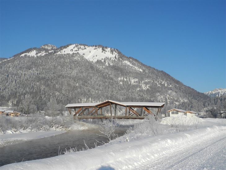
Achendammrundweg Winter

Winter walking

4,20 km

01:30 h

20 hm

597 m

Best Time of Year

Jan

Feb

Mar

Apr

May

Jun

Jul

Aug

Sep

Oct

Nov

Dec

Information

Start at Kössen tourist office, turn off onto the Mühlbachweg streetl at the Alpine dairy. Walk through the pedestrian underpass, over the Staffenbrücke bridge then left along the Kössener Ache river along the Uferweg (riverbank trail) no. 14 southwards over the Kohlbachbrücke bridge. After the bridge, continue on to the

Read more ...

Recommended Equipment

Breathable outdoor clothing suitable for the weather, sturdy footwear, food (snacks, drinks),
sun protection (sunglasses, sun cream & cap), rain protection, cash; guest card if using the bus

Map & Elevation Profile

Arrival

By car to the centre of Kössen.

Similar Tour Suggestions

Walchsee - Wandberghütte

Medium

Hiking

Snowshoe hiking

Starting Point: Moarhof

End Point: Wandberghütte

7,60 km

03:30 h

750 hm

352 hm

1367 m

Rodelbahn - Aschinger

Easy

Sledding

Tobogganing

3,20 km

315 hm

Closed
Jausenstation Mühlberghof - Nr. 21

Easy

Hiking

Winter walking

Hiking tour

+1

Starting Point: Tourist Office Kössen

End Point: Jausenstation Mühlberghof

2,60 km

02:00 h

223 hm

804 m

Schwendt - Kohlental

Easy

Hiking

Winter walking

Starting Point: Schwendt

End Point: Gasthof Hohenkendl

8,50 km

03:00 h

87 hm

Rettenschöss - Flecken

Easy

Hiking

Winter walking

Starting Point: Rettenschöss

End Point: Flecken

1,70 km

01:00 h

250 hm

923 m

Hochberg Circuit

Easy

Hiking

Winter walking

Starting Point: Tourist Office Walchsee

End Point: Tourist Office Walchsee

7,60 km

02:30 h

190 hm

804 m

Seerundweg - Nr. 38

Easy

Hiking

Winter walking

Hiking tour

Starting Point: Tourist Office Walchsee

End Point: Tourist Office Walchsee

5,50 km

01:30 h

30 hm

Around the Kalvarienberg in Kössen

Easy

Hiking

Winter walking

Starting Point: Tourist Office Kössen

End Point: Tourist Office Kössen

3,00 km

01:00 h

50 hm

655 m