Hiking

Medium

Josefstalrunde / Walchsee-Kössen - Nr. 40

5,60 km

02:00 h

220 hm

Best Time of Year

Jan

Feb

Mar

Apr

May

Jun

Jul

Aug

Sep

Oct

Nov

Dec

Information

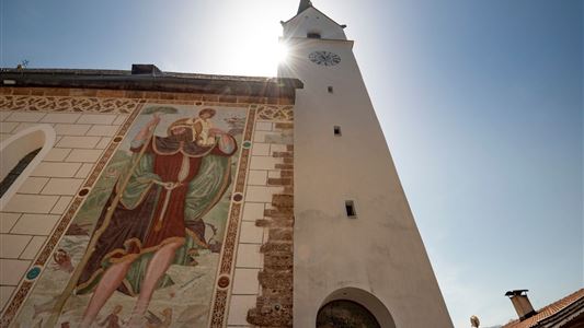
Starting point is the square in front of the newly renovated church, with its Neo-Romanesque high altar and beautiful Neo-Baroque ceiling paintings. In the attic of the church is the largest bat colony in Tyrol. From there, continue along Kirchgasse and Dorfplatz, cross the main road, pass the Gasthof Fischerwirt,

Read more ...

Recommended Equipment

Breathable outdoor clothing suitable for the weather, sturdy footwear, food (snacks, drinks),
sun protection (sunglasses, sun cream & cap), rain protection, cash; guest card if using the bus

Features & Characteristics

Endurance

Skill Level

Huts & Alpine Pastures

Starting Point

Parish church Walchsee

End Point

Parish church Walchsee

Map & Elevation Profile

Arrival

The trail starts at the village center of Walchsee, next to the church.

Similar Tour Suggestions

Medium

Hiking

Hiking tour

4,10 km

02:00 h

222 hm

217 hm

881 m

Edernalm - Rudersburg  - Nr. 24

Hard

Hiking

Hiking tour

Starting Point: Parking lot Steinbauer

End Point: Parking lot Steinbauer

13,30 km

04:30 h

911 hm

882 hm

1431 m

Straubinger Haus / Eggenalm

Hard

Hiking

Hiking tour

Starting Point: Loferberg Kössen

End Point: Straubinghaus

18,00 km

07:00 h

1230 hm

1740 m

Stubenalm - Nr. 72

Easy

Hiking

Hiking tour

Starting Point: Hohenkendel Schwendt

End Point: Stubenalm

4,00 km

03:00 h

379 hm

135 hm

1032 m

Moosen - Peternhof - Nr. 9

Easy

Hiking

Hiking tour

Starting Point: Village Center Kössen

End Point: Peternhof

3,10 km

01:30 h

306 hm

798 m

 Karspitze - Wandberg Rundwanderung - Nr. 14, 47a

Medium

Hiking

Hiking tour

Starting Point: Gasthaus Schöne Aussicht in Rettenschöss

End Point: Gasthaus Schöne Aussicht in Rettenschöss

11,00 km

05:00 h

594 hm

592 hm

Village Loop - Kössen - Nr. 14

Hiking

Starting Point: Starting point roundabout in Kössen

End Point: Ending point roundabout in Kössen

3,90 km

01:00 h

594 m

Priener Hütte - Karkopf - Nr. 47, 56, 87

Medium

Hiking

Hiking tour

Starting Point: Tourist Office Walchsee

End Point: Tourist Office Walchsee

18,20 km

06:00 h

1118 hm

1093 hm

1451 m