Hiking

Medium

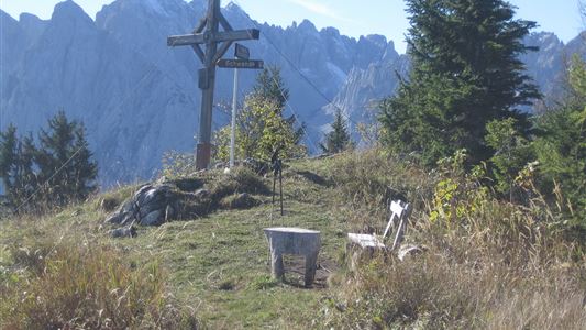
Lippenalm

Hiking tour

Family-friendly

4,40 km

01:30 h

310 hm

939 m

Information

Start: From the Walchsee tourist office, walk west and after the pizzeria, turn left over the Ramsbachbrücke bridge. Pass behind the indoor tennis courts to the Seestrasse road then continue on left to the turn-off for the Lippenalm.  From the turn-off, follow the medium-difficult trail to the Lippenalm. Route can

Read more ...

Recommended Equipment

Breathable outdoor clothing suitable for the weather, sturdy footwear, food (snacks, drinks),
sun protection (sunglasses, sun cream & cap), rain protection, cash; guest card if using the bus

Features & Characteristics

Starting Point

Centre Walchsee

End Point

Lippenalm

Family-friendly

Yes

Map & Elevation Profile

Similar Tour Suggestions

Um den Ramsbach

Easy

Hiking

Hiking tour

Starting Point: Tourist Office Walchsee

End Point: Tourist Office Walchsee

2,80 km

01:00 h

35 hm

694 m

Premium hike Quellenweg Schwendt - Nr. 61, 64

Hiking

Hiking tour

+1

Starting Point: Parking lot near the Kaiserwinkl fish ponds

End Point: Parking Lot Dankl, Kohlental, Schwendt

3,10 km

01:00 h

21 hm

14 hm

675 m

Big Griesbach Loop

Medium

Hiking

Hiking tour

Starting Point: Erpfendorf - Parking lot Griesbachklamm

End Point: Erpfendorf - Parking lot Griesbachklamm

6,10 km

02:10 h

223 hm

862 m

Closed
Kössen - Gundharting - Walchsee Nr. 13

Easy

Hiking

Hiking tour

Starting Point: Tourist Office Kössen

End Point: Tourist Office Walchsee

8,90 km

02:30 h

228 hm

159 hm

706 m

Stripsenjochhaus - Feldalmsattel - Heuberg - Walchsee - Nr.  87, 811, 88, 89, 88

Medium

Hiking

Hiking tour

Starting Point: Stripsenjochhaus

End Point: Walchsee

16,90 km

06:00 h

829 hm

1740 hm

1601 m

Partially Open
Griesenau - Stripsenjoch - Nr. 801, 825

Medium

Hiking

Hiking tour

Starting Point: Griesneralm

End Point: Stripsenjochhaus

3,50 km

04:30 h

633 hm

58 hm

1578 m

Kohlentalrunde - Schwendt - Nr. 61

Easy

Hiking

Starting Point: Town hall Schwendt

End Point: Town hall Schwendt

5,50 km

01:30 h

82 hm

Schwendt - Aschentalrunde

Medium

Hiking

Hiking tour

Winter walking

Starting Point: Tourist Office Schwendt

End Point: Tourist Office Schwendt

2,30 km

01:00 h

72 hm