Hiking

Easy

Kleine Schwendterrunde

Hiking tour

4,90 km

01:00 h

131 hm

Best Time of Year

Jan

Feb

Mar

Apr

May

Jun

Jul

Aug

Sep

Oct

Nov

Dec

Information

Start at the information office in Schwendt in direction Moarwirt, here turn right the way to Mühlau.
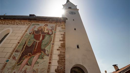
Continue to the right at the Kohlbach until the second large wooden bridge then left of the road to the center Schwendt, at the church left over to the hamlet Schlecht then follow the

Read more ...

Recommended Equipment

appropriate clothing, proper footwear, backpack, rain protection, possibly hiking poles, mobile phone, sunscreen, snacks and drinks, possibly photo camera

Features & Characteristics

Starting Point

Infobüro Schwendt

End Point

Infobüro Schwendt

Map & Elevation Profile

Arrival

Coming from Kössen is the starting point on the left side in the centre of the village.

Similar Tour Suggestions

Around  Kössen  - Nr. 12, 7, 9, 2

Easy

Hiking

Hiking tour

Starting Point: Tourist Office Kössen

End Point: Tourist Office Kössen

9,40 km

02:30 h

81 hm

82 hm

647 m

Walchsee - Ottenalm - Nr. 47

Easy

Hiking

Hiking tour

Starting Point: Tourist Office Walchsee

End Point: Ottenalm

3,50 km

01:30 h

309 hm

950 m

Rettenschöss Feistenau - in Richtung Wandberg - Nr. 47A, 14

Easy

Hiking

Hiking tour

Starting Point: Gasthaus Schöne Aussicht in Rettenschöss

End Point: Gasthaus Schöne Aussicht in Rettenschöss

9,00 km

03:30 h

353 hm

1326 m

Unterberg

Hard

Hiking

Hiking tour

Starting Point: Gondelbahn Unterberg

End Point: Gondelbahn Unterberg

17,60 km

07:00 h

1325 hm

1336 hm

1749 m

Big Griesbach Loop

Medium

Hiking

Hiking tour

Starting Point: Erpfendorf - Parking lot Griesbachklamm

End Point: Erpfendorf - Parking lot Griesbachklamm

6,10 km

02:10 h

223 hm

862 m

Stubenalm - Schnappen Nr. 72

Medium

Hiking

Hiking tour

Starting Point: Hohenkendel Schwendt

End Point: Schnappen

7,80 km

04:30 h

935 hm

135 hm

1469 m

Edernalm - Rudersburg  - Nr. 24

Hard

Hiking

Hiking tour

Starting Point: Parking lot Steinbauer

End Point: Parking lot Steinbauer

13,30 km

04:30 h

911 hm

882 hm

1431 m

Lippenalm

Medium

Hiking

Hiking tour

Starting Point: Dorfzentrum Walchsee

End Point: Lippenalm

4,40 km

01:30 h

310 hm

939 m