Hiking

Medium

Karspitze - Wandberg Rundwanderung

Hiking tour

Family-friendly

+1

11,00 km

05:00 h

594 hm

592 hm

Best Time of Year

Jan

Feb

Mar

Apr

May

Jun

Jul

Aug

Sep

Oct

Nov

Dec

Information

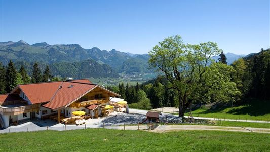
The small town Rettenschöss is closest to the broad Inn Valley and is also only 5 minutes away from the motorway exit Oberaudorf. You start the hike on 980 meters of altitude. Immediately after Gasthaus Schöne Aussicht, the signs point towards Karspitze. From there you can enjoy a long-distance view

Read more ...

Recommended Equipment

Breathable outdoor clothing suitable for the weather, sturdy footwear, food (snacks, drinks),
sun protection (sunglasses, sun cream & cap), rain protection, cash; guest card if using the bus

Features & Characteristics

Starting Point

Gasthaus Schöne Aussicht in Rettenschöss

End Point

Gasthaus Schöne Aussicht in Rettenschöss

Family-friendly

Yes

Loop tour

Yes

Map & Elevation Profile

Arrival

It is recommended to travel by car. Coming from Walchsee follow the B172 in the direction of Niederndorf. In the district of Primau turn right and follow the asphalt road for five kilometers to the public parking Feistenau near the Gasthaus Schöne Aussicht. Guests of the Kaiserwinkl can park there

Read more ...

Similar Tour Suggestions

Gasthaus Schöne Aussicht zur Wildbichlalm

Easy

Hiking

Hiking tour

Starting Point: Gasthaus Schöne Aussicht

End Point: Gasthaus Schöne Aussicht

2,10 km

01:15 h

107 hm

1094 m

Lippenalm- Ebersberg - Gwirchtalm

Medium

Hiking

Hiking tour

Starting Point: Parking lot Tennishalle Walchsee or Parking lot Lippenalm

End Point: Parking lot Tennishalle Walchsee or Parking lot Lippenalm

11,00 km

04:30 h

487 hm

1140 m

Partially Open
Hochbergrunde - Walchsee

Easy

Hiking

Hiking tour

Starting Point: Parkplatz Liftanlagen Zahmer Kaiser

End Point: Parkplatz Liftanlagen Zahmer Kaiser

5,80 km

01:45 h

123 hm

über die Almen von Walchsee nach Kössen - Nr. 54, 47a, 3, 14, 8, 87,24

Medium

Hiking

Hiking tour

Starting Point: Walchsee

End Point: Kössen

21,60 km

08:00 h

1521 hm

1588 hm

1641 m

Kaiserbachtal - Griesner Alm - Nr. 80

Easy

Hiking

Hiking tour

Starting Point: Gasthof Griesenau

End Point: Griesner Alm

5,30 km

03:00 h

320 hm

46 hm

1003 m

Scheibenkogel

Medium

Hiking

Hiking tour

Starting Point: Tourist Office Schwendt

End Point: Mountaintop Scheibenkogel

6,80 km

06:30 h

959 hm

1579 m

Hausberg - Haraualm - Josefstal

Medium

Hiking

Hiking tour

Starting Point: Centre Walchsee

End Point: Centre Walchsee

9,20 km

04:00 h

912 hm

1035 m

Straubinger Haus / Eggenalm - Nr. 27

Hard

Hiking

Hiking tour

Starting Point: Hagerbrücke

End Point: Straubingerhaus

18,00 km

07:00 h

1230 hm

1740 m