Hiking

Easy

Achendammrunde - Transformationen

Hiking tour

Family-friendly

+2

4,90 km

01:15 h

4 hm

590 m

Best Time of Year

Jan

Feb

Mar

Apr

May

Jun

Jul

Aug

Sep

Oct

Nov

Dec

Information

Start is at the info office in Kössen. From there you walk over the roundabout into the Alleestraße. After the shoe shop Schermer, turn right at the Bernard photo onto the path leading to Achendamm. Keep right at the fork and continue to Staffenbrücke, cross the bridge and walk across

Read more ...

Recommended Equipment

Breathable outdoor clothing suitable for the weather, sturdy footwear, food (snacks, drinks),
sun protection (sunglasses, sun cream & cap), rain protection, cash; guest card if using the bus

Features & Characteristics

Starting Point

Tourist Office Kössen

End Point

Tourist Office Kössen

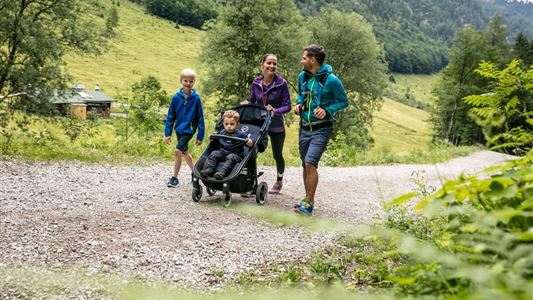
Family-friendly

Yes

Stroller-friendly

Yes

Loop tour

Yes

Map & Elevation Profile

Arrival

All the way to Kössen to the information office.

Similar Tour Suggestions

Moosen - Peternhof

Easy

Hiking

Hiking tour

Starting Point: Village Center Kössen

End Point: Peternhof

3,10 km

01:30 h

306 hm

798 m

Village Loop - Kössen - Nr. 14

Hiking

Starting Point: Starting point roundabout in Kössen

End Point: Ending point roundabout in Kössen

3,90 km

01:00 h

594 m

Berggasthof Zahmer Kaiser - Aschingeralm

Medium

Hiking

Hiking tour

Starting Point: Under the Church in Walchsee

End Point: Parking Lot Liftstation Zahmer Kaiser

9,30 km

02:30 h

415 hm

376 hm

1005 m

Stubenalm

Easy

Hiking

Hiking tour

Starting Point: Hohenkendel Schwendt

End Point: Stubenalm

4,00 km

03:00 h

379 hm

135 hm

1032 m

Straubinger Haus / Eggenalm - Nr. 27

Hard

Hiking

Hiking tour

Starting Point: Hagerbrücke

End Point: Straubingerhaus

18,00 km

07:00 h

1230 hm

1740 m

Marienweg

Medium

Hiking

Hiking tour

Thematic route

+1

Starting Point: Niederndorf - Sebi

End Point: Reit im Winkl oder Kirchdorf

61,40 km

2018 hm

2031 hm

Stubenalm

Medium

Hiking

Hiking tour

Starting Point: Hohenkendel Schwendt

End Point: Schnappen

7,80 km

04:30 h

935 hm

135 hm

1469 m

Hard

Hiking

Hiking tour

Starting Point: Parking lot Staffen

End Point: Parking lot Staffen

11,25 km

05:00 h

1259 hm

1262 hm

1393 m