Hiking

Easy

Große Schwendterrunde

Hiking tour

Family-friendly

+1

9,50 km

02:00 h

93 hm

138 hm

Best Time of Year

Jan

Feb

Mar

Apr

May

Jun

Jul

Aug

Sep

Oct

Nov

Dec

Information

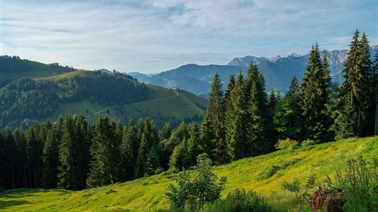
Start at the Dorfladl in Schwendt to Moarwirt, take the right trail to Mühlau, the Kohlbach along to the inn Hohenkendl. Follow the road for about 1 km until you reach the lane on the left and continue to the wooden bridge, then follow the signs to Schwendt. At the

Read more ...

Recommended Equipment

appropriate clothing, proper footwear, backpack, rain protection, possibly hiking poles, mobile phone, sunscreen, snacks and drinks, possibly photo camera

Map & Elevation Profile

Arrival

Coming from Kössen is on the left side is the start at the Raiffeisenbank

Similar Tour Suggestions

Lucknerhof

Medium

Hiking

Winter walking

Hiking tour

Starting Point: Sportplatz Kössen

End Point: Sportplatz Kössen

9,80 km

03:00 h

292 hm

175 hm

720 m

Haraualm

Medium

Hiking

Winter walking

Hiking tour

+1

Starting Point: Hallbruckhof

End Point: Haraualm

3,30 km

01:30 h

330 hm

1004 m

Priener Hütter - Karkopf

Medium

Hiking

Hiking tour

Starting Point: Infobüro Walchsee

End Point: Infobüro Walchsee

18,20 km

06:00 h

1118 hm

1093 hm

1451 m

Schwemmrunde

Easy

Hiking

Hiking tour

Starting Point: Infobüro Walchsee

End Point: Infobüro Walchsee

6,50 km

01:30 h

50 hm

Unterberghorn

Hard

Hiking

Hiking tour

Starting Point: Parkplatz Unterbergbahn

End Point: Unterberg Gipfelkreuz

8,60 km

04:00 h

1294 hm

168 hm

1751 m

Schwendt – Aschental Circuit

Medium

Hiking

Winter walking

Hiking tour

Starting Point: Dorfzentrum Schwendt

End Point: Dorfzentrum Schwendt

2,30 km

01:00 h

72 hm

Dorfrunde - Kalvarienberg

Easy

Hiking

Starting Point: 92

End Point: Pfarrkirche Walchsee

2,40 km

02:30 h

96 hm

92 m

Lippenalm- Ebersberg - Gwirchtalm

Medium

Hiking

Hiking tour

Starting Point: Walchsee

End Point: Walchsee

11,00 km

04:30 h

487 hm

1140 m