Hiking

Medium

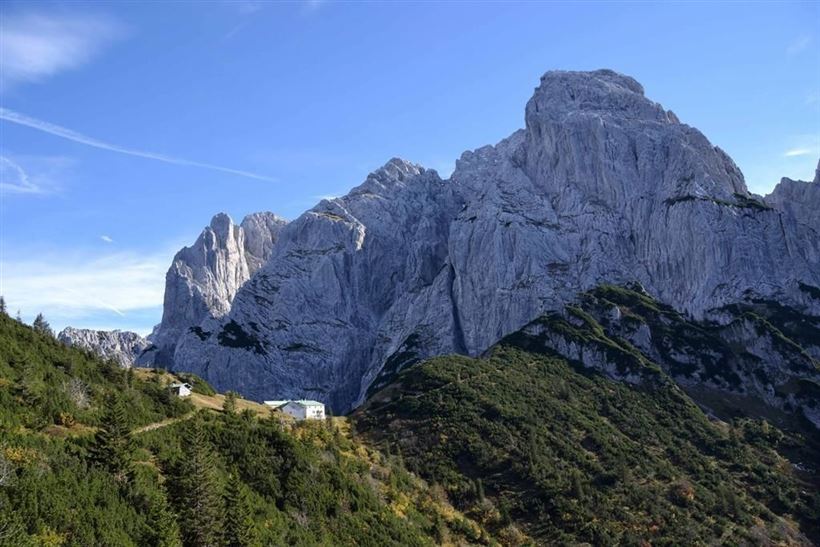
Griesenau - Stripsenjoch - Nr. 801, 825

Hiking tour

3,50 km

04:30 h

633 hm

58 hm

1578 m

Best Time of Year

Jan

Feb

Mar

Apr

May

Jun

Jul

Aug

Sep

Oct

Nov

Dec

Information

You drive via Schwendt to Griesenau and from there a toll road leads to Kaiserbachtal. You can park there in front of the toll booth and walk along the approx. 4 km Schnackler adventure trail with outdoor gallery to the Griesner Alm. Or you go by car to the Griesner

Read more ...

Recommended Equipment

Breathable outdoor clothing suitable for the weather, sturdy footwear, food (snacks, drinks),
sun protection (sunglasses, sun cream & cap), rain protection, cash; guest card if using the bus

Features & Characteristics

Endurance

Skill Level

Starting Point

Griesneralm

End Point

Stripsenjochhaus

Map & Elevation Profile

Arrival

By car through Schwendt to the district of Griesenau (district of Kirchdorf i.T.)

Similar Tour Suggestions

Premiumwanderweg Kugelwand - Harauspitze Nr.: 49,47

Medium

Hiking

Hiking tour

Thematic route

+1

Starting Point: Parking lot footballfield

End Point: Parking lot footballfield

6,50 km

04:00 h

475 hm

445 hm

1115 m

Seerundweg - Nr. 38

Easy

Hiking

Winter walking

Hiking tour

Starting Point: Tourist Office Walchsee

End Point: Tourist Office Walchsee

5,50 km

01:30 h

30 hm

Wildbichlalm - Nr. 14

Easy

Hiking

Hiking tour

Starting Point: Ritzgraben car park - Rettenschöss

End Point: Ritzgraben car park - Rettenschöss

5,00 km

02:00 h

330 hm

1040 m

Schwendt - Bichlach - Nr. 61a

Easy

Hiking

Winter walking

Hiking tour

Starting Point: Schwendt Village Center

End Point: Riedlwirt

3,50 km

01:00 h

30 hm

710 m

Straubinger Haus / Eggenalm - Nr. 27

Hard

Hiking

Hiking tour

Starting Point: Hagerbrücke

End Point: Straubingerhaus

18,00 km

07:00 h

1230 hm

1740 m

Niederhausertal - Lackalm - Nr. 70

Medium

Hiking

Hiking tour

Starting Point: Fire Station Schwendt

End Point: Lackalm

9,50 km

06:00 h

884 hm

260 hm

1331 m

Habersauertal - Raineralm - Lippenalm - Nr. 87, 52

Medium

Hiking

Hiking tour

Starting Point: Parking lot Ostufer Walchsee

End Point: Parking lot Ostufer Walchsee

11,20 km

03:30 h

560 hm

1096 m

Hochschanz / Kalvarienberg - Kössen - Nr. 21,2

Easy

Hiking

Starting Point: 92

End Point: Pfarrkirche Walchsee

2,40 km

02:30 h

96 hm

92 m