Hiking

Easy

Große Schwendterrunde - 61,64

Hiking tour

Family-friendly

+1

9,50 km

02:00 h

93 hm

138 hm

Best Time of Year

Jan

Feb

Mar

Apr

May

Jun

Jul

Aug

Sep

Oct

Nov

Dec

Information

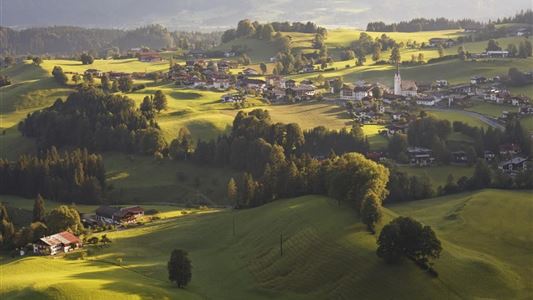
Start at the Dorfladl in Schwendt to Moarwirt, take the right trail to Mühlau, the Kohlbach along to the inn Hohenkendl. Follow the road for about 1 km until you reach the lane on the left and continue to the wooden bridge, then follow the signs to Schwendt. At the

Read more ...

Recommended Equipment

Breathable outdoor clothing suitable for the weather, sturdy footwear, food (snacks, drinks),
sun protection (sunglasses, sun cream & cap), rain protection, cash; guest card if using the bus

Map & Elevation Profile

Arrival

Coming from Kössen is on the left side is the start at the Raiffeisenbank

Similar Tour Suggestions

Niederhausertal - Lackalm - Nr. 70

Medium

Hiking

Hiking tour

Starting Point: Fire Station Schwendt

End Point: Lackalm

9,50 km

06:00 h

884 hm

260 hm

1331 m

Straubinger Haus / Eggenalm - Nr. 27

Hard

Hiking

Hiking tour

Starting Point: Hagerbrücke

End Point: Straubingerhaus

18,00 km

07:00 h

1230 hm

1740 m

Premium hike Quellenweg Schwendt - Nr. 61, 64

Hiking

Hiking tour

+1

Starting Point: Parking lot near the Kaiserwinkl fish ponds

End Point: Parking Lot Dankl, Kohlental, Schwendt

3,10 km

01:00 h

21 hm

14 hm

675 m

Berggasthof Zahmer Kaiser - Aschingeralm - Nr. 45, 49

Medium

Hiking

Hiking tour

Starting Point: Under the Church in Walchsee

End Point: Parking Lot Liftstation Zahmer Kaiser

9,30 km

02:30 h

415 hm

376 hm

1005 m

 Karspitze - Wandberg Rundwanderung - Nr. 14, 47a

Medium

Hiking

Hiking tour

Starting Point: Gasthaus Schöne Aussicht in Rettenschöss

End Point: Gasthaus Schöne Aussicht in Rettenschöss

11,00 km

05:00 h

594 hm

592 hm

Moosen - Peternhof - Nr. 9

Easy

Hiking

Hiking tour

Starting Point: Village Center Kössen

End Point: Peternhof

3,10 km

01:30 h

306 hm

798 m

Stubenalm - Schnappen Nr. 72

Medium

Hiking

Hiking tour

Starting Point: Hohenkendel Schwendt

End Point: Schnappen

7,80 km

04:30 h

935 hm

135 hm

1469 m

Wildbichlalm - Nr. 14

Easy

Hiking

Hiking tour

Starting Point: Ritzgraben car park - Rettenschöss

End Point: Ritzgraben car park - Rettenschöss

5,00 km

02:00 h

330 hm

1040 m