Hiking

Medium

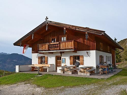
Stubenalm - Schnappen Nr. 72

Hiking tour

7,80 km

04:30 h

935 hm

135 hm

1469 m

Best Time of Year

Jan

Feb

Mar

Apr

May

Jun

Jul

Aug

Sep

Oct

Nov

Dec

Information

From Schwendt in the direction of St. Johann in Tirol turn off to the left side about 200 m before Gasthaus Hohenkendl before a bridge left into the meadows. Here are some parking areas. You walk along the meadow path, first at the junction at Putzenhof left and walk along

Read more ...

Recommended Equipment

appropriate clothing, proper footwear, backpack, rain gear, possibly hiking poles, cell phone, sunscreen, snack (bread time) and drinks, possibly photo camera

Features & Characteristics

Endurance

Skill Level

Starting Point

Hohenkendel Schwendt

End Point

Schnappen

Map & Elevation Profile

Arrival

By car to Schwendt to the district Kohlental and continue to the beginning of Griesenau.

Similar Tour Suggestions

Leitwang

Easy

Hiking

Hiking tour

6,70 km

02:00 h

92 hm

93 hm

670 m

Habersautal-Feldalm-Hochalm

Medium

Hiking

Hiking tour

Starting Point: Walchsee

End Point: Walchsee

22,80 km

07:00 h

1178 hm

1024 hm

1420 m

Partially Open
Schöne Aussicht- Wildbichlam - Wandberg

Medium

Hiking

Hiking tour

Starting Point: Parkplatz Faistenau

End Point: Parkplatz Faistenau

12,60 km

05:30 h

686 hm

1440 m

Große Schwendterrunde

Easy

Hiking

Hiking tour

9,50 km

02:00 h

93 hm

138 hm

Riederalm

Easy

Hiking

Winter walking

Hiking tour

Starting Point: Dorfzentrum Walchsee

End Point: Riederalm

3,00 km

01:00 h

181 hm

850 m

Naringalm

Medium

Hiking

Hiking tour

12,40 km

04:00 h

591 hm

592 hm

1178 m

Schwendt-E-Werk-Schwendt

Easy

Hiking

Hiking tour

Starting Point: Infobüro Schwendt

End Point: Infobüro Schwendt

8,10 km

02:00 h

181 hm

Dorfrunde - Josefstal

Medium

Hiking

Starting Point: Pfarrkirche Walchsee

End Point: Pfarrkirche Walchsee

5,60 km

02:00 h

220 hm