Hiking

Medium

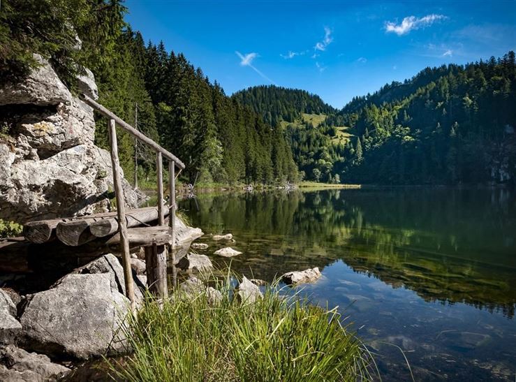
Schwarzwald - Taubensee - Nr. 22

Hiking tour

Family-friendly

+1

11,20 km

03:30 h

630 hm

1176 m

Best Time of Year

Jan

Feb

Mar

Apr

May

Jun

Jul

Aug

Sep

Oct

Nov

Dec

Information

Starting point is the Erlebnis-Waldschwimmbad (adventure forest swimming pool).
Shortly after the turnoff to the Erlebnis-Waldschwimmbad Kössen, we leave the Klobenstein road on the right and follow a meadow and forest path into the Schwarzwald (Black Forest).
We hike above the Mühlberg stream, continuing on to the Ast zu Moosen-Alm.
From there, we

Read more ...

Recommended Equipment

Breathable outdoor clothing suitable for the weather, sturdy footwear, food (snacks, drinks),
sun protection (sunglasses, sun cream & cap), rain protection, cash; guest card if using the bus

Features & Characteristics

Starting Point

Tourist Office Kössen

End Point

Tourist Office Kössen

Family-friendly

Yes

Loop tour

Yes

Map & Elevation Profile

Arrival

By car to Kössen

Similar Tour Suggestions

Around  Kössen  - Nr. 12, 7, 9, 2

Easy

Hiking

Hiking tour

Starting Point: Tourist Office Kössen

End Point: Tourist Office Kössen

9,40 km

02:30 h

81 hm

82 hm

647 m

Haraualm

Medium

Hiking

Winter walking

Hiking tour

+1

Starting Point: Hallbruckhof

End Point: Haraualm

3,30 km

01:30 h

330 hm

1004 m

Stripsenjochhaus - Feldalmsattel - Heuberg - Walchsee - Nr.  87, 811, 88, 89, 88

Medium

Hiking

Hiking tour

Starting Point: Stripsenjochhaus

End Point: Walchsee

16,90 km

06:00 h

829 hm

1740 hm

1601 m

Walchsee - Ottenalm - Nr. 47

Easy

Hiking

Hiking tour

Starting Point: Tourist Office Walchsee

End Point: Ottenalm

3,50 km

01:30 h

309 hm

950 m

Dorfrunde - Schwendt - Nr. 63

Easy

Hiking

Starting Point: Municipal office of Schwendt

End Point: Municipal office of Schwendt

1,80 km

00:40 h

50 hm

752 m

Village Loop - Kössen - Nr. 14

Hiking

Starting Point: Starting point roundabout in Kössen

End Point: Ending point roundabout in Kössen

3,90 km

01:00 h

594 m

Vier Elemente Weg - Nr. 36

Easy

Hiking

Hiking tour

Starting Point: Tourist Office Walchsee

End Point: Tourist Office Walchsee

1,80 km

01:00 h

40 hm

701 m

Dorfrunde Rettenschöss - Nr. 39

Easy

Hiking

Starting Point: Municipal office Rettenschöss

End Point: Municipal office Rettenschöss

5,60 km

01:30 h

116 hm

667 m