Hiking

Medium

Habersautal-Feldalm-Hochalm - Nr. 87,88

Hiking tour

22,88 km

07:00 h

1178 hm

1024 hm

1420 m

Best Time of Year

Jan

Feb

Mar

Apr

May

Jun

Jul

Aug

Sep

Oct

Nov

Dec

Information

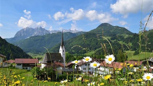
From the tourist office in Walchsee follow the main road in the direction of Kössen to the Seehotel Brunner. Here you turn right, after the bridge left, to the next junction in the road. Here you turn left and then right again. The forest road follows the Weißenbach along Habersauertal to

Read more ...

Recommended Equipment

Breathable outdoor clothing suitable for the weather, sturdy footwear, food (snacks, drinks),
sun protection (sunglasses, sun cream & cap), rain protection, cash; guest card if using the bus.

Features & Characteristics

Starting Point

Information Office Walchsee

End Point

Information Office Walchsee

Map & Elevation Profile

Arrival

By car to the village centre of Walchsee

Similar Tour Suggestions

Kössen - Unterberghorn - Nr. 26

Hard

Hiking

Hiking tour

Starting Point: Parkplatz Unterbergbahn

End Point: Unterberg Gipfelkreuz

8,60 km

04:00 h

1294 hm

168 hm

1751 m

Ottenalm - Harauspitze

Medium

Hiking

Hiking tour

Starting Point: Football field parking lot

End Point: Football field parking lot

6,50 km

04:00 h

475 hm

445 hm

1115 m

Schmugglerweg Klobenstein Nr. 15

Medium

Hiking

Hiking tour

+1

Starting Point: Tourist Office Roundabout Kössen

End Point: Klobenstein

4,10 km

03:00 h

143 hm

658 m

Vier Elemente Weg - Nr. 36

Easy

Hiking

Hiking tour

Starting Point: Tourist Office Walchsee

End Point: Tourist Office Walchsee

1,80 km

01:00 h

40 hm

701 m

Marienweg

Medium

Hiking

Hiking tour

Thematic route

+1

Starting Point: Niederndorf - Sebi

End Point: Reit im Winkl oder Kirchdorf

61,40 km

2018 hm

2031 hm

Rettenschöss Feistenau - in Richtung Wandberg - Nr. 47A, 14

Easy

Hiking

Hiking tour

Starting Point: Gasthaus Schöne Aussicht in Rettenschöss

End Point: Gasthaus Schöne Aussicht in Rettenschöss

9,00 km

03:30 h

353 hm

1326 m

über die Almen von Walchsee nach Kössen - Nr. 54, 47a, 3, 14, 8, 87,24

Medium

Hiking

Hiking tour

Starting Point: Walchsee

End Point: Kössen

21,60 km

08:00 h

1521 hm

1588 hm

1641 m

Kohlalm - Feldberg

Medium

Hiking

Hiking tour

8,10 km

06:30 h

1195 hm

111 hm

1771 m