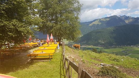
Hiking

Medium

Blaik - Peternhof - Kössen - Nr. 9

Hiking tour

8,00 km

02:30 h

240 hm

761 m

Best Time of Year

Jan

Feb

Mar

Apr

May

Jun

Jul

Aug

Sep

Oct

Nov

Dec

Information

Start at tourist info in Kössen, pass by the tennis café until you reach the track, follow the track until you arrive at Adventure Club Kaiserwinkl. There you have to turn right and walk across Blaik to Faistental. Take the path through the forest to get to Hotel Peternhof. There

Read more ...

Recommended Equipment

Breathable outdoor clothing suitable for the weather, sturdy footwear, food (snacks, drinks),
sun protection (sunglasses, sun cream & cap), rain protection, cash; guest card if using the bus

Features & Characteristics

Starting Point

Tourist Office Kössen

End Point

Tourist Office Kössen

Map & Elevation Profile

Arrival

To the information office in Kössen

Similar Tour Suggestions

Große Schwendterrunde

Easy

Hiking

Hiking tour

9,50 km

02:00 h

93 hm

138 hm

Pyramidenspitze - Vorderkaiserfelden

Hard

Hiking

Hiking tour

Starting Point: Parkplatz Hochberg Durchholzen

End Point: Parkplatz Hochberg Durchholzen

17,60 km

09:00 h

1665 hm

1999 m

Edernalm  - Nr. 24

Easy

Hiking

Hiking tour

3,20 km

01:00 h

337 hm

918 m

Schwendt - Bichlach

Easy

Hiking

Winter walking

Hiking tour

Starting Point: Schwendt Dorfzentrum

End Point: Riedlwirt

3,50 km

01:00 h

30 hm

710 m

Naringalm

Medium

Hiking

Hiking tour

12,40 km

04:00 h

591 hm

592 hm

1178 m

Kössen-Walchsee-Gundharting

Easy

Hiking

Hiking tour

Starting Point: Staffenbrücke Kössen

End Point: Ortszentrum Walchsee

8,90 km

02:30 h

228 hm

159 hm

706 m

Habersautal-Feldalm-Hochalm - Nr. 87,88

Medium

Hiking

Hiking tour

Starting Point: Information Office Walchsee

End Point: Information Office Walchsee

22,88 km

07:00 h

1178 hm

1024 hm

1420 m

Lucknerhof

Medium

Hiking

Winter walking

Hiking tour

Starting Point: Sportplatz Kössen

End Point: Sportplatz Kössen

9,80 km

03:00 h

292 hm

175 hm

720 m