Hiking

Easy

Kaiserbachtal - Griesner Alm - Nr. 80

Hiking tour

Family-friendly

+1

5,30 km

03:00 h

320 hm

46 hm

1003 m

Best Time of Year

Jan

Feb

Mar

Apr

May

Jun

Jul

Aug

Sep

Oct

Nov

Dec

Information

Opposite the Gasthof Griesenau begins the hike and you go on the toll road to the bridge. Take the trail on the left side, which leads slightly uphill into the nature parc Kaiserbachtal. On the way you will find the unique Alpine Outdoor Gallery, which describes popular hikers closer, for the

Read more ...

Recommended Equipment

Breathable outdoor clothing suitable for the weather, sturdy footwear, food (snacks, drinks),
sun protection (sunglasses, sun cream & cap), rain protection, cash; guest card if using the bus

Features & Characteristics

Endurance

Skill Level

Starting Point

Gasthof Griesenau

End Point

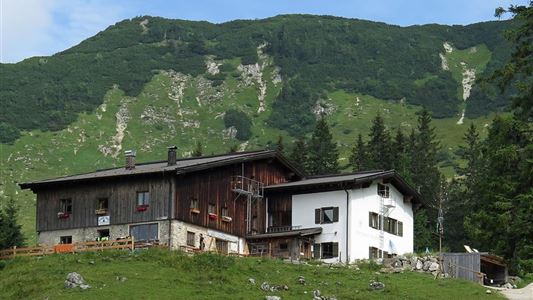
Griesner Alm

Family-friendly

Yes

Stroller-friendly

Yes

Map & Elevation Profile

Arrival

By car through Schwendt to Griesenau.

Similar Tour Suggestions

Kugelwandrunde

Medium

Hiking

Hiking tour

4,10 km

02:00 h

222 hm

217 hm

881 m

Brennkopf

Medium

Hiking

Hiking tour

Starting Point: Schwemmturm Walchsee

End Point: Schwemmturm Walchsee

8,60 km

04:00 h

738 hm

1330 m

Scheibenkogel

Medium

Hiking

Hiking tour

Starting Point: Tourist Office Schwendt

End Point: Mountaintop Scheibenkogel

6,80 km

06:30 h

959 hm

1579 m

Big Griesbach Loop

Medium

Hiking

Hiking tour

Starting Point: Erpfendorf - Parking lot Griesbachklamm

End Point: Erpfendorf - Parking lot Griesbachklamm

6,10 km

02:10 h

223 hm

862 m

Kaiserbachtal

Easy

Hiking

Hiking tour

Starting Point: Kirchdorf i.T. hiking parking lot Kaiserbachtal

End Point: Kirchdorf i.T. hiking parking lot Kaiserbachtal

10,10 km

03:15 h

256 hm

263 hm

992 m

Schöne Aussicht- Wildbichlam - Wandberg

Medium

Hiking

Hiking tour

Starting Point: Parking lot Faistenau

End Point: Parking lot Faistenau

12,60 km

05:30 h

686 hm

1440 m

Hochalm - Heuberg

Medium

Hiking

Hiking tour

Starting Point: Parking lot Hochberg

End Point: Parking lot Hochberg

15,80 km

06:30 h

1252 hm

1247 hm

1603 m

Achendammrunde - Transformationen

Easy

Hiking

Hiking tour

Starting Point: Tourist Office Kössen

End Point: Tourist Office Kössen

4,90 km

01:15 h

4 hm

590 m